

Geographic Information Science lecturer Dr. Pramaditya Wicaksono and a team of researchers have developed a digital image processing toolbox for automatic mapping of seagrass sequestration and aboveground carbon stocks.
The research involves lecturers, researchers, and students from wide-ranging national and international institutions, such as the BRIN’s Oceanographic Research Center and Space Research Center, the Geospatial Information Agency, the University of Queensland, Wageningen University and Research, and TH Köln.
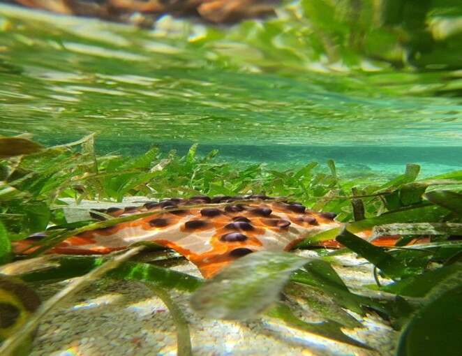
Although seagrass beds cover less than 1% of the earth’s oceans, they store about 18% of the total carbon in the oceans. The ability of seagrass beds to absorb carbon and bury it in sediments is more than 30 times higher than that of tropical rainforests, known as high carbon sequestration ecosystems.
Unlike the other blue carbon ecosystems such as mangroves or coral reefs, seagrass beds have been below the radar despite their tremendous contribution to reducing greenhouse gas emissions and mitigating climate change. The economic value of seagrass ecosystem services (19,004 USD/ha/year) is also much higher than that of mangrove forests (9,990 USD/ha/year) and coral reefs (6,075 USD/ha/year).
Furthermore, it is estimated that 30% of the world’s seagrass meadows have disappeared. Seagrass meadows decrease by almost 1 hectare every 30 minutes or 2 – 5% per year. Compared to coral reefs and mangrove forests, there are far fewer seagrass restoration efforts.
“Seagrass ecosystem services have not been widely exposed and are still less popular than other blue carbon ecosystems such as coral reefs and mangrove forests,” said Wicaksono.
Making up 5 to 10% of the world’s seagrass meadows, Indonesia has yet to optimize the management of seagrass and its ecosystem services. According to 2018 data validated by the BRIN’s Oceanographic Research Center, the estimated area of seagrass beds in Indonesia is only 293,464 ha or around 16 – 35% of the country’s potential area.
Efforts to improve this situation include acquiring data and causes of changes and reductions in seagrass beds in Indonesia and mapping the spatial and temporal distribution of seagrass beds and their biophysical information, such as species variation, percentage cover, biomass, carbon stock, and rate of carbon uptake. Having this information on a multi-temporal basis will help researchers identify the dynamics of seagrass ecosystems.
“It will take a long time, personnel with special competencies, and large funds for conventional surveys of seagrass beds in Indonesia. We lack historical data regarding the spatial and temporal distribution of seagrass beds. For this reason, we develop remote sensing data processing methods to map seagrass beds,” he explained.
As suggested by the United Nations Environment Programme (UNEP), remote sensing is the main approach to complementing the sparse global dataset on the spatial distribution of seagrass beds and mapping of seagrass ecosystem services.
“Given the breadth of the blue carbon ecosystems in Indonesia, the country will have a more significant role in climate change adaptation and mitigation by having this information and incorporating it in the NDCs,” he said.
Since 2013, the UGM Coastal Biodiversity Remote Sensing Research Group has formulated numerous remote sensing methods to map varied parameters of blue carbon ecosystems, including seagrass beds and mangrove forests. Some of them are for mapping spatial and temporal distribution, species, percentage cover, leaf area index, carbon stock, and carbon sequestration of seagrass beds.
The Research Group has also developed a spectral library for various seagrass species in Indonesia, worked on algorithms and toolboxes for automatic mapping of seagrass carbon reserves and sequestration, mapped and monitored the dynamics of seagrass beds, and analyzed the impact of human activities on changes in seagrass cover area and the collapse of seagrass ecosystems.
Author: Ika